AI BIẾT TUỐT:
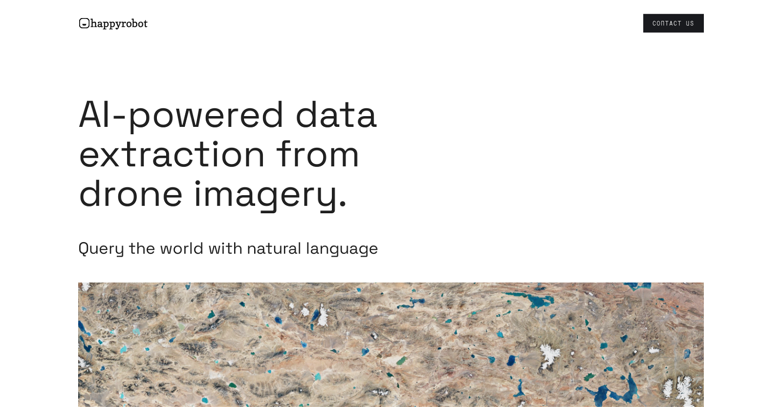
Happyrobot là một công cụ AI được thiết kế để trích xuất dữ liệu định lượng từ hình ảnh không gian địa lý bằng cách sử dụng truy vấn ngôn ngữ tự nhiên. Nó cho phép người dùng chuyển đổi hình ảnh không gian địa lý, bao gồm hình ảnh vệ tinh, máy bay không người lái và trên không, thành dữ liệu có cấu trúc cho mục đích ra quyết định.
Công cụ này cung cấp tùy chọn tải lên hình ảnh tùy chỉnh hoặc sử dụng hình ảnh có nguồn gốc từ đối tác. Sử dụng một ví dụ, người dùng có thể tìm thấy tất cả các đối tượng quan tâm trong toàn bộ tập dữ liệu và mô tả chúng bằng ngôn ngữ tự nhiên.
Happyrobot cung cấp nhiều tùy chọn xuất khác nhau, bao gồm email, PDF, ArcGis và API, cho phép người dùng truy cập và sử dụng dữ liệu được trích xuất.
Công cụ này được các nhóm dữ liệu hàng đầu tin cậy và có cơ sở khách hàng vững chắc. Ngoài ra, Happyrobot còn cung cấp các mối quan hệ đối tác cho phép chủ sở hữu dữ liệu kiếm tiền từ tài sản của họ bằng cách xây dựng mô hình AI và tạo dựng niềm tin để tạo ra các luồng doanh thu định kỳ. Nhìn chung, Happyrobot đóng vai trò là một phi công phụ AI, sử dụng các thuật toán nâng cao và kỹ thuật máy học để tự động phân tích hình ảnh không gian địa lý và trích xuất các hình ảnh có giá trị data.
Bằng cách cho phép người dùng tương tác với công cụ thông qua ngôn ngữ tự nhiên, nó tạo điều kiện thuận lợi cho việc khám phá thế giới dựa trên truy vấn một cách liền mạch. Cho dù đó là quy hoạch đô thị, giám sát môi trường hay bất kỳ ứng dụng không gian địa lý nào khác, Happyrobot đều cung cấp giải pháp đáng tin cậy và hiệu quả để chuyển đổi hình ảnh không gian địa lý thành dữ liệu có cấu trúc.


Đánh giá
Chưa có đánh giá nào.